
Volume 378 -
International Symposium on Grids & Clouds 2021 (ISGC2021) -
Earth/Environmental Sciences Applications
A new method for geomorphological studies and land cover classification using Machine Learning techniques
Full text:
pdf
Published on:
October 22, 2021
Abstract
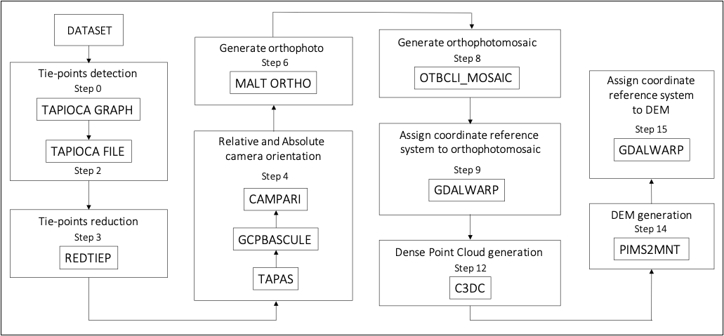
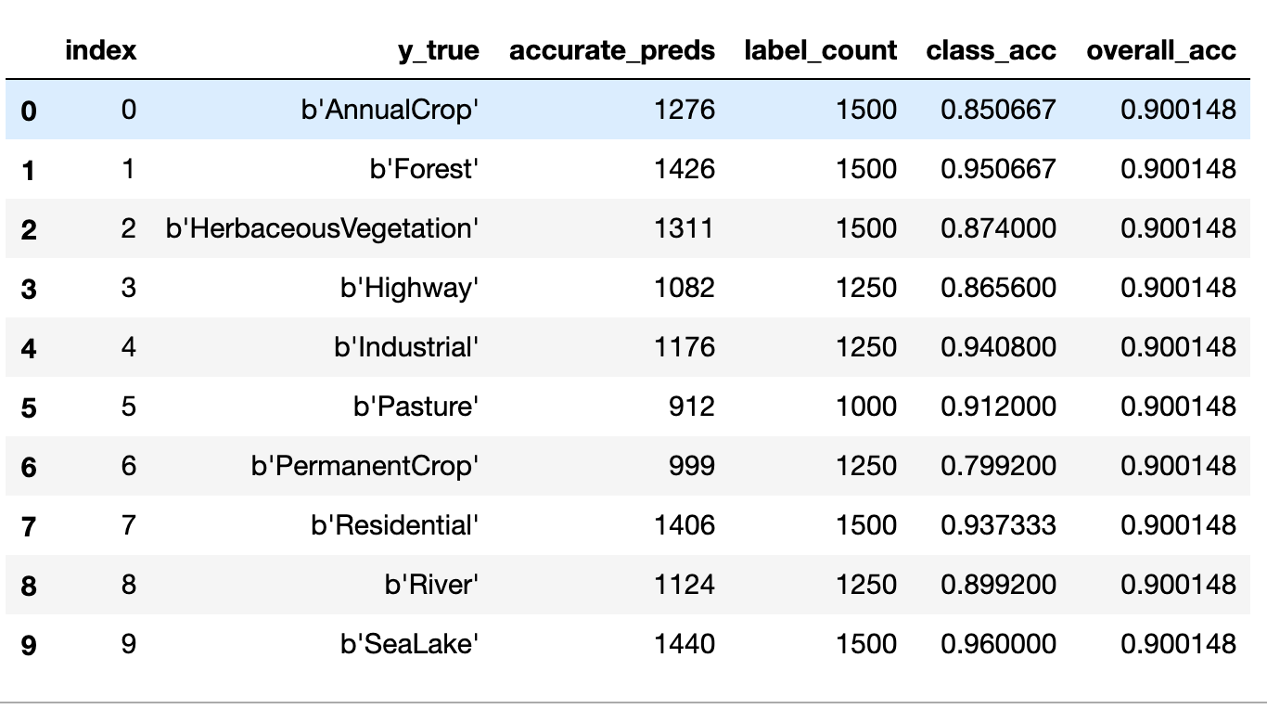
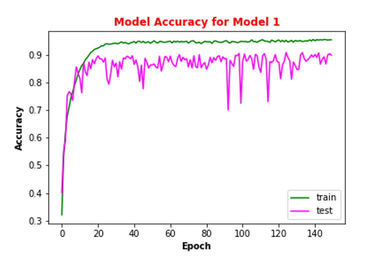
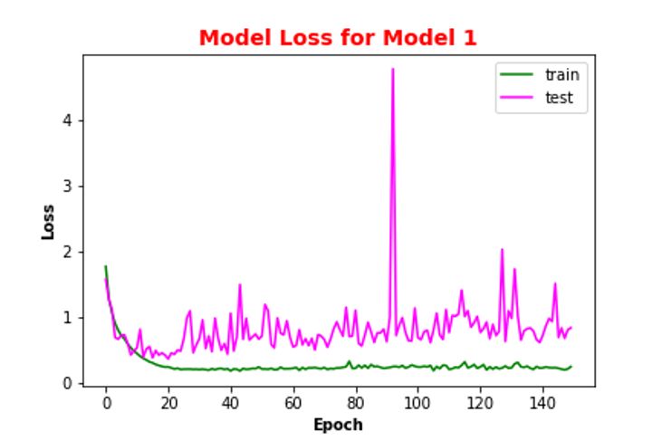
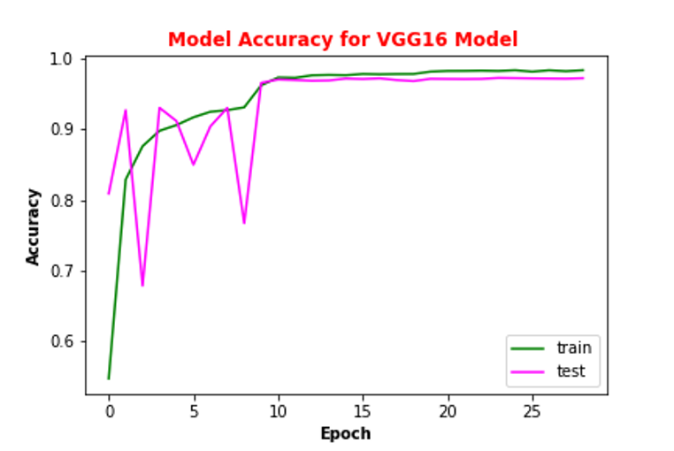
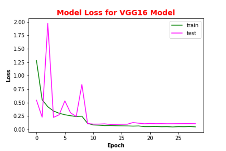
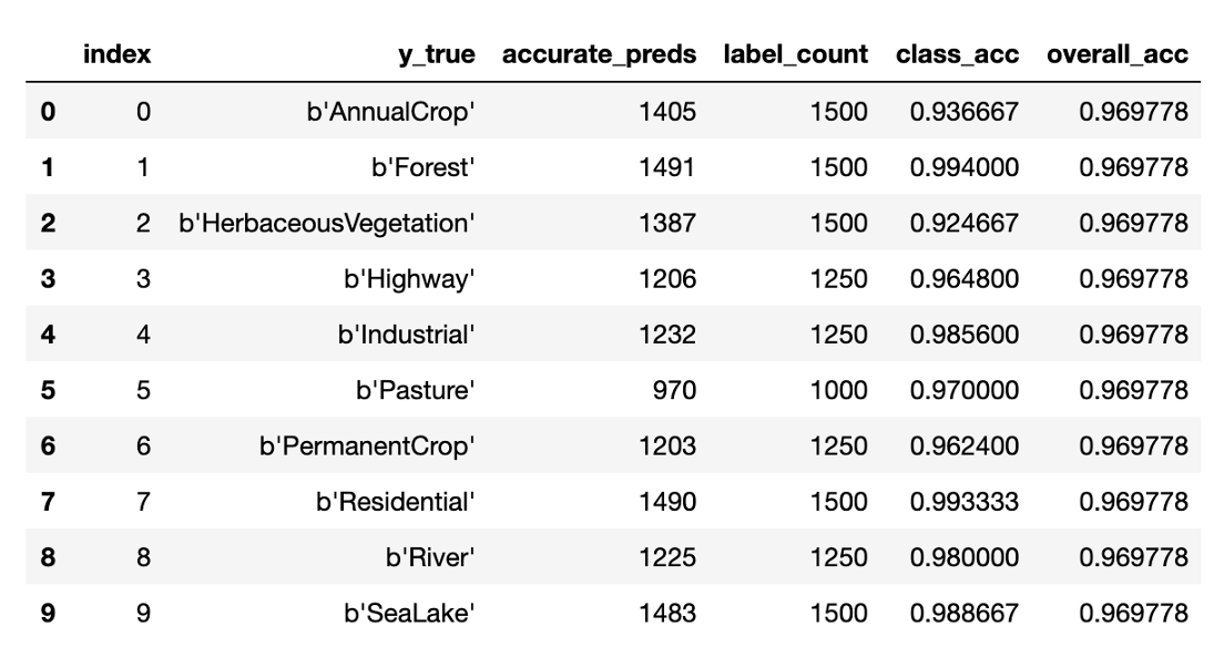
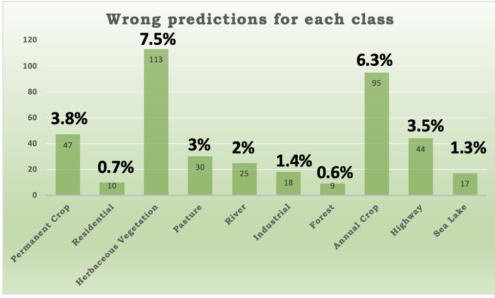
The processing of aerial high-resolution images is key for territorial mapping and change detection analysis in hydro-geomorphological high-risk areas. A new method has been developed in the context of CLOSE (Close to the Earth) project, resulting in a workflow based on open source MicMac photogrammetric suite and on High-Performance Computing. The workflow allowed to process a sequence of more than 1000 drone images captured along a reach belonging to the Basento River in Basilicata (Italy) during one single run.The workflow optimisation aims to extract the orthophotomosaic, the point cloud and the Digital Surface Model (DSM) of selected areas. The high quality of the image details can be used for land cover classification and extrapolating features useful to mitigate the hydro-geomorphological hazard, through Machine Learning models trained with satellite public data. Several Convolutional Neural Networks have been tested using progressively more complex layer sequences, data augmentation and callback techniques for training procedures. The results are given in terms of model accuracy and loss.
DOI: https://doi.org/10.22323/1.378.0031
How to cite
Metadata are provided both in "article" format (very similar to INSPIRE) as this helps creating very compact bibliographies which can be beneficial to authors and readers, and in "proceeding" format which is more detailed and complete.
Open Access
 Copyright owned by the author(s) under the term of the Creative Commons Attribution-NonCommercial-NoDerivatives 4.0 International License.
Copyright owned by the author(s) under the term of the Creative Commons Attribution-NonCommercial-NoDerivatives 4.0 International License.